| RBGPF | -4.54% | 59.31 | $ | |
| AZN | 0.97% | 67.235 | $ | |
| RELX | -0.62% | 46.48 | $ | |
| SCS | -2.45% | 11.03 | $ | |
| GSK | -1.61% | 33.215 | $ | |
| CMSC | 0.13% | 23.129 | $ | |
| NGG | -2.8% | 56.4 | $ | |
| RIO | 0.54% | 58.95 | $ | |
| BTI | -1.52% | 36.191 | $ | |
| BCC | -1.76% | 115.37 | $ | |
| CMSD | -0.3% | 23.33 | $ | |
| BCE | -2.74% | 22.999 | $ | |
| RYCEF | 0.28% | 7.22 | $ | |
| BP | 0.34% | 31.225 | $ | |
| VOD | -1.55% | 8.085 | $ | |
| JRI | -0.49% | 12.16 | $ |

How climate change boosts hurricanes
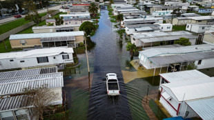
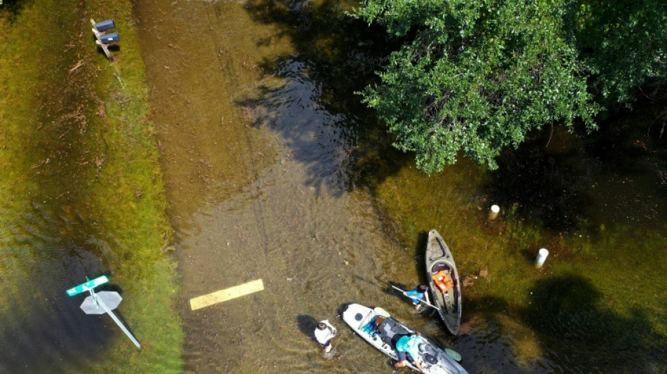
Scientists are sounding the alarm on human-caused climate change's impact on hurricanes such as Idalia, which rapidly intensified over a warm Gulf of Mexico before making landfall in Florida on Wednesday.
Here's what you need to know.
- Record-warm oceans counter El Nino -
Back in May, the US National Oceanic and Atmospheric Administration (NOAA) predicted a "near normal" Atlantic hurricane season, which runs from June 1 to November 30.
That was in large part because of the El Nino global weather pattern, which causes a higher than average "vertical wind shear" in the Atlantic, which in turn suppresses hurricane activity.
"If you have big changes in the wind with height, that tends to import dry, lower-energy air into the core of a tropical cyclone and prevent it from strengthening," Allison Wing, an atmospheric scientist at Florida State University, told AFP.
But come August, NOAA increased its forecast prediction for the season to "above normal," based on ocean and atmospheric conditions "such as record-warm Atlantic sea surface temperatures" that "are likely to counterbalance the usually limiting atmospheric conditions associated with the ongoing El Nino event."
"It's been a sort of tricky year in terms of thinking about the whole seasonal forecast because we have these two opposing factors," said Wing.
- What is known about climate change -
One-eye catching example: on July 24 a buoy off the southern tip of Florida recorded an alarming peak temperature of 101.1 degrees Fahrenheit (38.4 Celsius), readings more commonly associated with hot tubs, and a possible new world record.
"Warm waters, both at the surface of the ocean and beneath, provide the fuel that intensifies tropical storms and hurricanes," said Michael Mann, a climatologist at University of Pennsylvania. "That allows them to both intensify faster and attain higher maximum intensities."
You still need the right conditions to lead to hurricane formation -- but when they come along, storms will take advantage of warming oceans to generate fiercer winds and cause bigger storm surges.
"You can think of climate change as sort of like loading the dice," added Wing. "There's still a variety of different possible outcomes for any individual storm, but you have a greater chance of having those high-intensity storms."
Apart from affecting the maximum intensity of hurricanes, climate change can also increase the amount of rain they are able to dump, Andrew Kruczkiewicz, an atmospheric scientist and researcher at the International Research Institute for Climate and Society at Columbia University, told AFP.
"The warmer the atmosphere is, the greater the capacity for water," he said. "This can mean increased intense precipitation events."
Kruczkiewicz added he was personally worried people who had moved inland to escape Idalia could find themselves caught nonetheless in extreme weather.
Last year, climate change boosted Hurricane Ian's rainfall by at least 10 percent, according to recent research.
- Seasons getting longer -
There's increasing evidence that the storm season itself is getting longer, as the window during which ocean surface temperatures support tropical storm formation begins sooner and ends later, said Mann -- a relationship that appears to hold true in both the Atlantic hurricane basin and the Bay of Bengal.
While there is ample research that climate change is making hurricanes more dangerous, whether it is also making them more frequent is much less certain and more study is required.
R.Martins--LiLuX
